Chapter 03 — Causes, Consequences & the Way Forward
A Governance Failure
Wearing a Flood's Face
1
Soil Extraction as a Force Multiplier
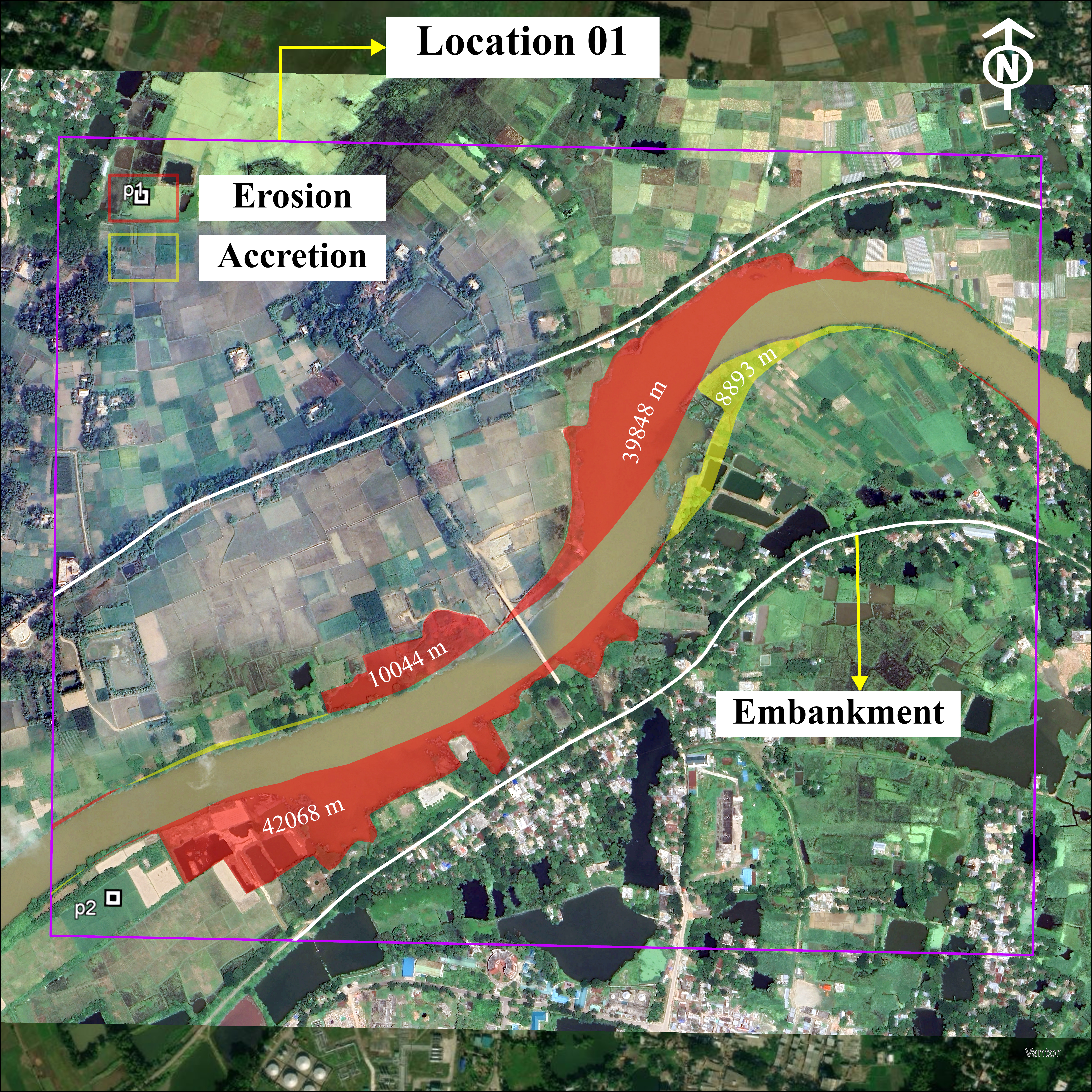
Brickfield operations adjacent to the Gumti have been removing floodplain and bank soil for years. Each cut reduces the bank's resistance to hydraulic shear, meaning the river can erode laterally with less energy — and does.
2
A Governance Gap, Not Just a Geomorphic One
Soil extraction near riverbanks persists through weak oversight, informal arrangements, and local political structures. The river's migration is partly a map of regulatory failure. Controlling extraction is therefore a flood-risk intervention.
3
The Embankment Is No Longer Buffered
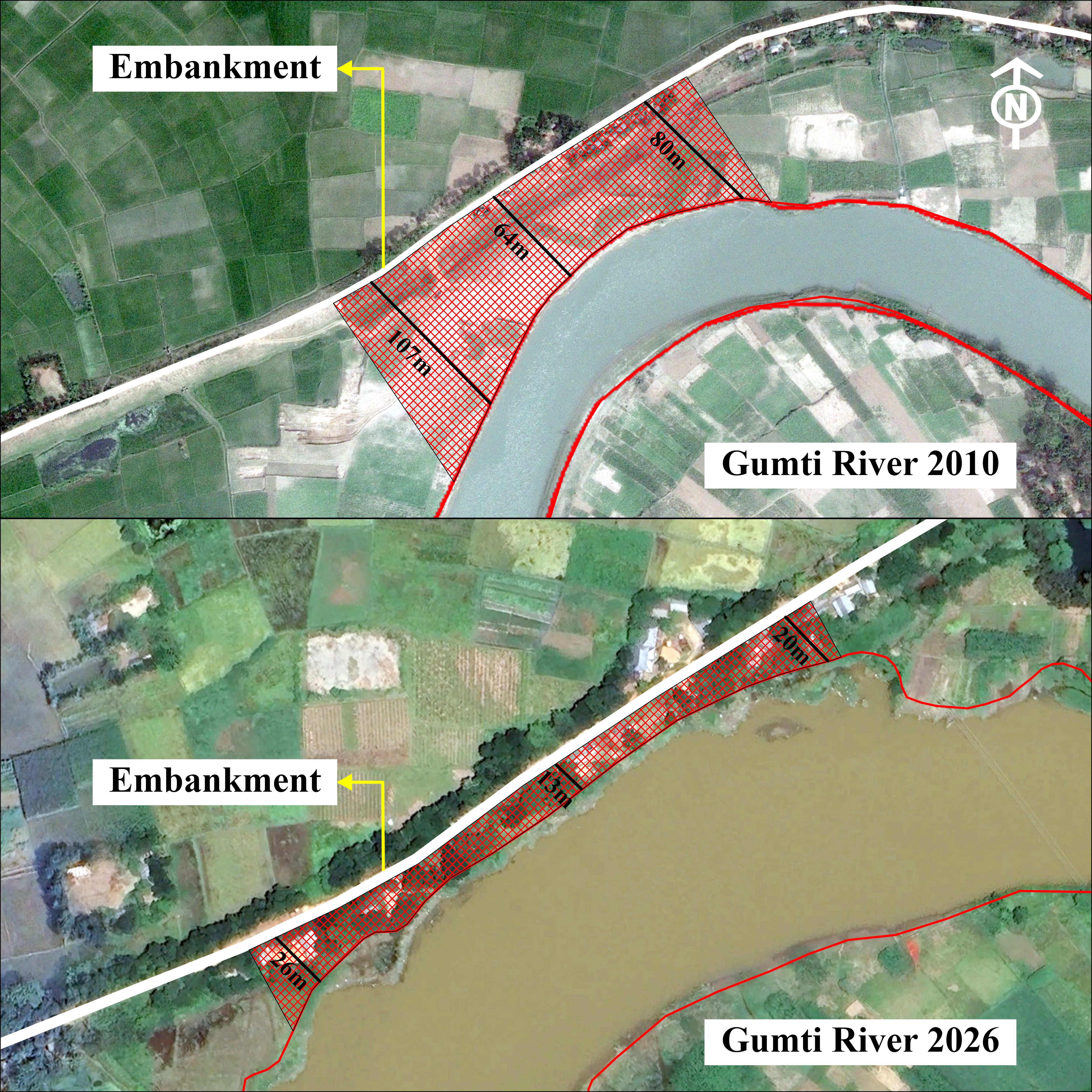
With buffers collapsed to 13–27 m in critical sections, direct lateral pressure from high-discharge flow now reaches embankment toe structures. Scouring, undercutting, and seepage can begin well before overtopping occurs.
4
2024 Was a Warning, Not an Anomaly
The embankment breach of 2024 is not an isolated extreme-weather event. It is the first observable output of a cumulative vulnerability that has been building since at least 2010. Without intervention, it will repeat.
Methodology
1
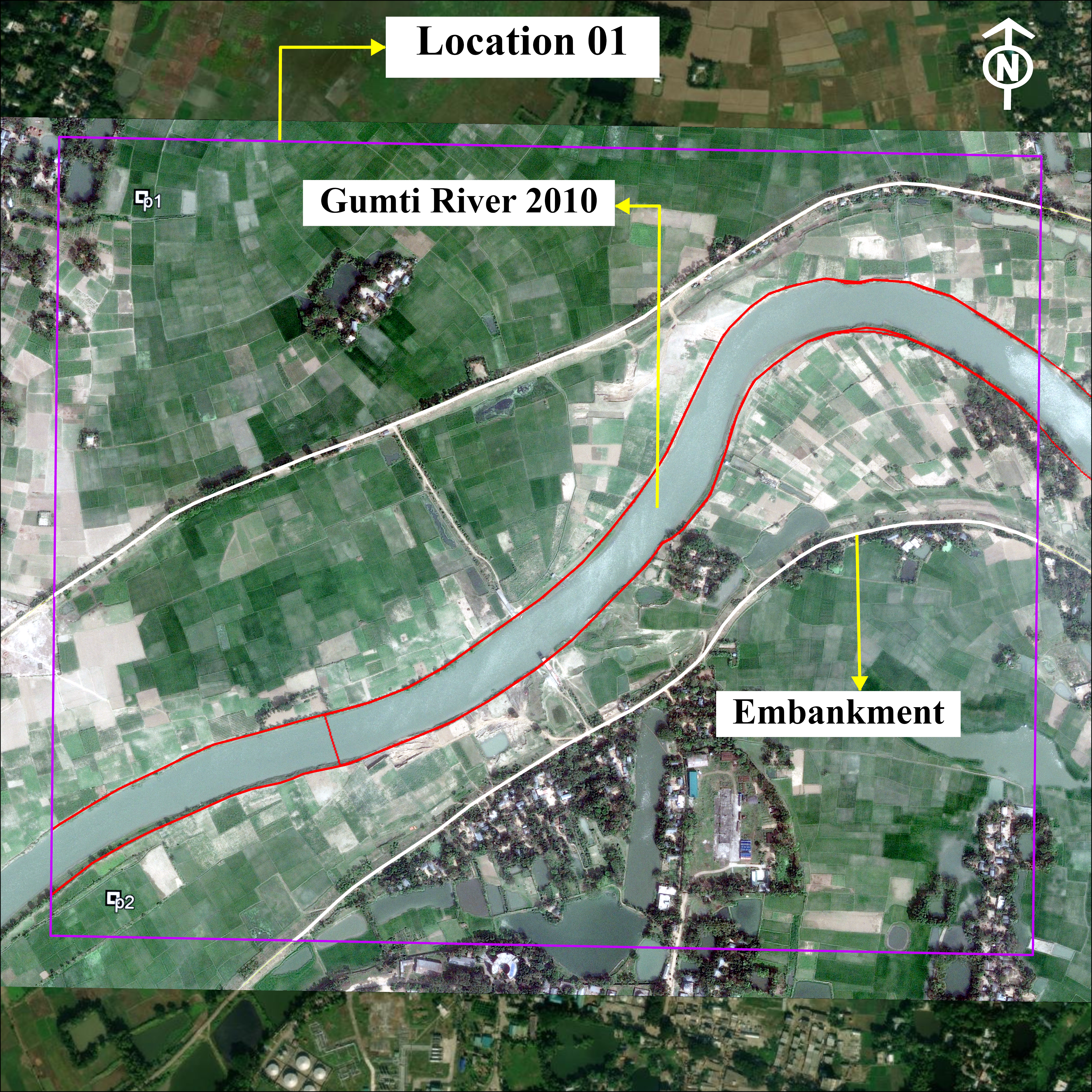
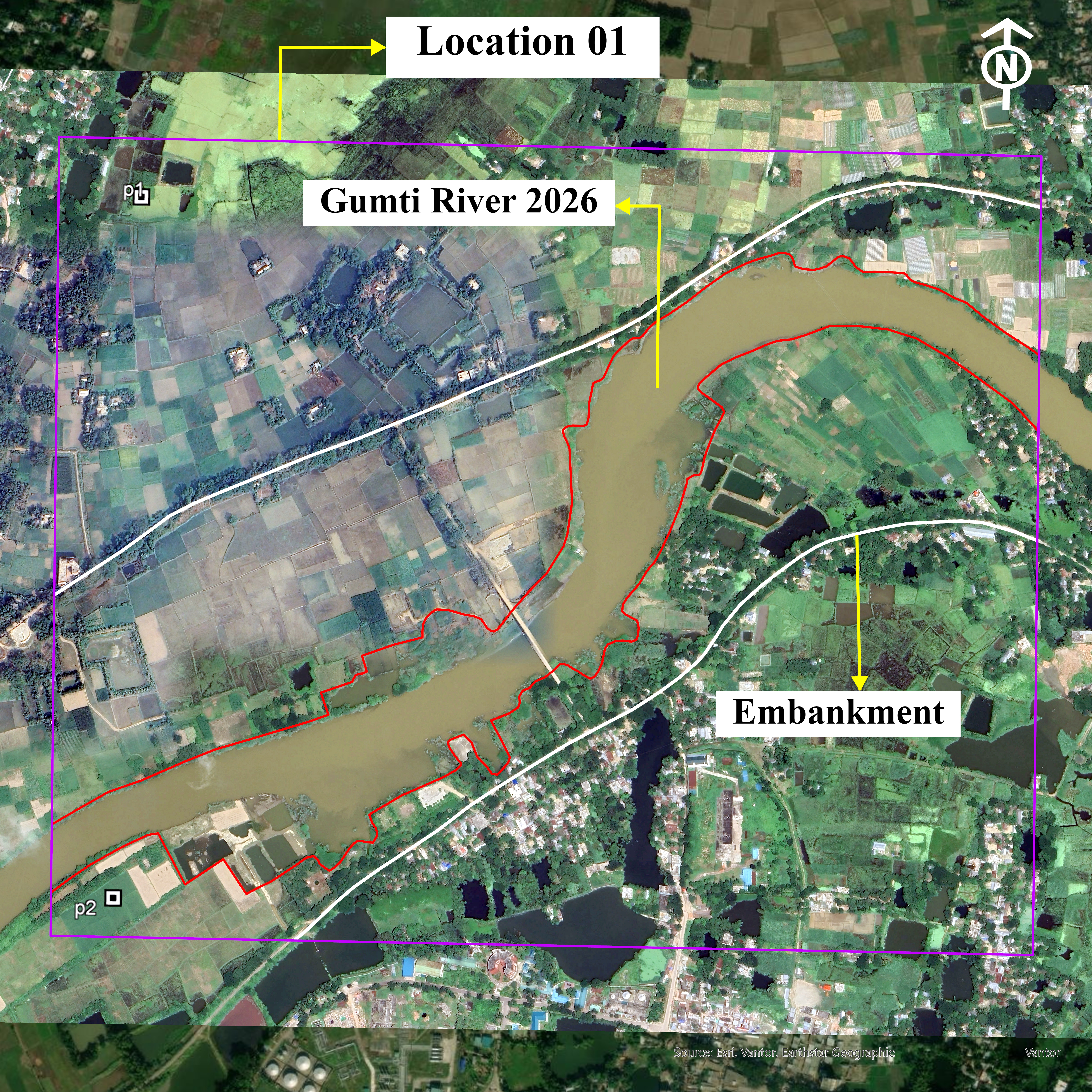
Image Acquisition: Historical satellite screenshots captured from Google Earth Pro for 2010 and 2026, along with KML reference coordinates at each location.
2
Georeferencing: KML control points imported to ArcGIS Pro and converted to shapefiles; images registered to a common spatial framework enabling accurate temporal comparison.
3
Digitization: River boundaries and embankment/buffer zones manually digitized for both years, producing spatial layers of river extent and bankline positions.
4
Change Analysis: Overlay of 2010 and 2026 boundaries to derive erosion and accretion polygons; area measurements and buffer distance assessments extracted for each location.
Muradnagar as Early Warning
This study focuses on Muradnagar, but the processes documented here — bank cutting, channel migration, erosion dominance, embankment encroachment — are likely operating at other points along the Gumti River where similar land-use pressures exist. Muradnagar is not an isolated anomaly; it is a leading indicator for the broader Cumilla corridor.
⚠ High Risk — Action Required
Unless unauthorized soil cutting is stopped and embankment-side river margins are actively protected, the Gumti River will continue advancing toward critical infrastructure. The probability of embankment damage during the next severe monsoon season is high and rising.
Risk Profile
Monsoon VulnerabilityVERY HIGH
The Gumti is not simply a river in flood — it is a river responding to human decisions. Every truckload of brickfield soil extracted from its banks is a vote for the next breach. The maps are clear. The choice that remains is whether to act before the embankment fails again, or after.
Data Sources
Google Earth Pro (2010, 2026 imagery) · ArcGIS Pro (georeferencing & digitization) · Esri, Vexcel, DigitalGlobe (basemap imagery) · Field observations, Muradnagar Upazila
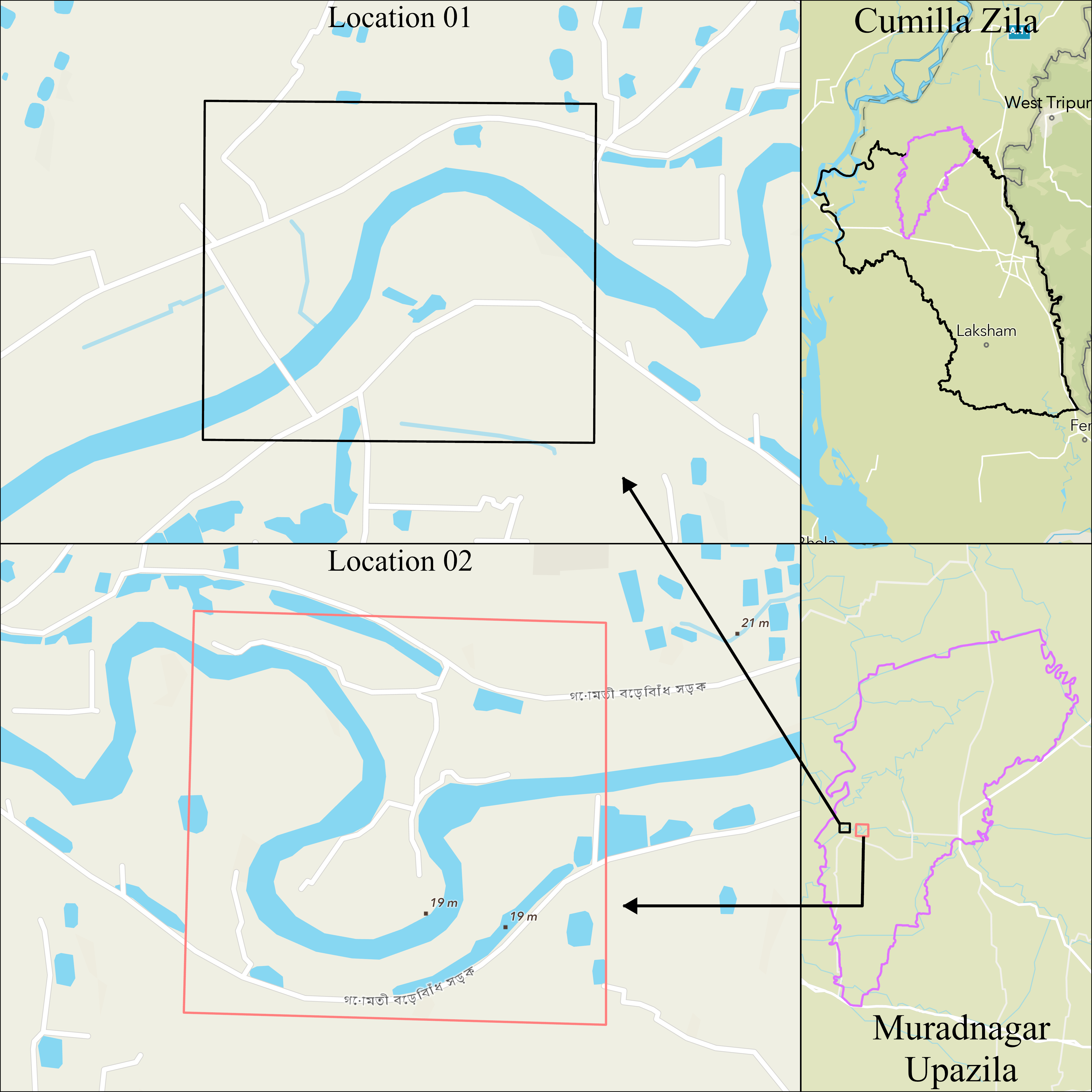
Study Area
Muradnagar Upazila
Cumilla District, Bangladesh