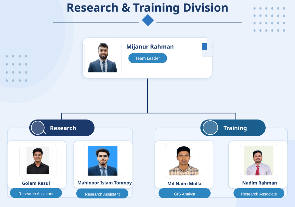
Team Leader (Research and Training Division), GREENS
Mijanur Rahman is a geospatial analyst and environmental researcher with expertise in GIS, remote sensing, and disaster management. He leads research and training initiatives within the Climate, Disaster & EIA Division at GREENS, where he contributes to spatial analysis, environmental assessments, and capacity-building activities.
He holds an MSc and BSc in Geography and Environmental Studies from the University of Chittagong, Bangladesh. He has worked on various interdisciplinary research projects and brings several years of experience in academic instruction and applied geospatial research.
► GIS & RS Division
Md Naim Molla
Research Analyst
Md Naim Molla works as a GIS, Remote Sensing, and Research Analyst at GREENS, where he develops initial methodologies for research projects and teaches GIS and remote sensing courses to students and professionals. He holds both an MSc and a BSc in Geography and Environmental Studies from the University of Chittagong, Bangladesh.
Before joining GREENS, Naim worked at the Center for Environmental and Geographic Information Services (CEGIS) for 1.5 years, contributing to two major projects. During this period, he gained extensive practical experience with ArcGIS, ArcGIS Pro, Google Earth Pro, and Google Earth Engine. His combined expertise in research design, spatial analysis, and instruction supports GREENS’ mission to deliver cutting-edge geospatial solutions for sustainable development.
MD NADIM RAHMAN
Research Associate
Md Nadim Rahman is a Research Associate at GREENS with expertise in GIS, machine learning, and remote sensing.
He holds a B.Sc. (Honors) in Oceanography from Shahjalal University of Science and Technology. He specializes in ocean-climate modeling and marine environmental dynamics, applying computational and data-driven approaches to address pressing global climate challenges. His work bridges physical oceanography with modern geospatial and machine learning technologies, with a strong preference for open-source tools, workflow automation, and reproducible science.
Mahinoor Islam Tonmoy
Research Assistant
Mahinoor Islam Tonmoy is currently in the role of Research Assistant at GREENS. He is deeply interested in applying GIS, remote sensing, and machine learning to investigate Earth surface processes, environmental change, and disaster dynamics. His research interests are centered at the intersection of geospatial analysis, disaster risk reduction, environmental assessment, and atmospheric science, where spatial data and advanced analytical approaches can contribute to more informed decision-making for a sustainable and resilient future.
Golam Rasul
Research Assistant
Golam Rasul is a Research Assistant at GREENS, Research and Training Division, whose work focuses on the interconnections among disasters, public health, and climate-related processes. His research employs Excel, SPSS, Python, Google Earth Engine, and ArcGIS to conduct temporal, statistical, and spatial analyses of complex environmental and health-related issues. In addition, he engages with public health research, with particular emphasis on adolescent behavior and related risk factors, supported by experience in qualitative research methods such as Key Informant Interviews (KII), In-Depth Interviews (IDI), and Focus Group Discussions (FGD). By combining geospatial analytics, climate science, and public health perspectives, his work contributes to evidence generation for informed planning, risk reduction, and community resilience.